Mot dal Gajer


Show all 4 images

Details
Description
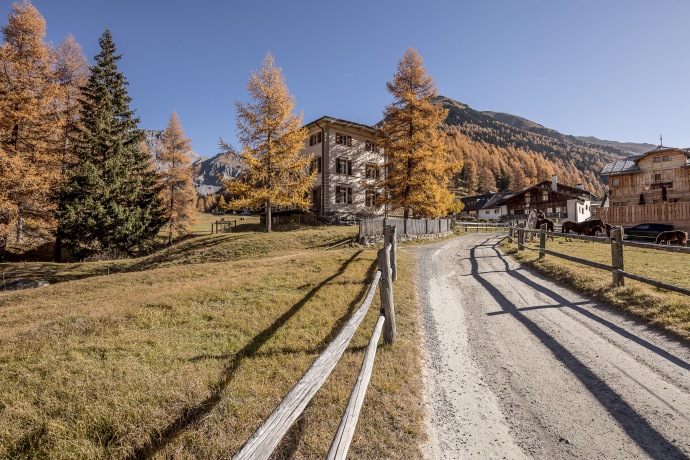
From the bus stop in the middle of the small mountain village of S-charl (at 1,800 m above sea level) to the Crusch Alba inn. Immediately after the terrace of this hotel, turn right and cross over a bridge to the other side of the river "La Clemgia". This is where the hiking trail begins. The signpost points in the direction of "Ils Mürins". The path is rather steep, but there are always flatter sections until you pass the forest and a wonderful view opens up! From here, there is no longer an official path, but the destination is clearly visible as it is right in front of your eyes, namely the Mot dal Gajer. On the Mot dal Gajer, the view extends as far as Italy, Austria and the Bernina group in the Upper Engadin.
The descent is on the other side of the mountain. First the path leads to Fuorcla Schombrina and then down to Alp Schombrina. From here there is another hiking trail that leads down to the river "la Clemgia". The trail leads back to S-charl along the wide dirt road.
Note on the tour: Please note that there is no signposting between Mürins - Mot dal Gaier and Fuorcla Schombrina and Plan d'Immez.
Sicherheitshinweis
The tour was evaluated in favorable weather conditions, the current weather conditions and weather forecasts must be observed before the start of the tour.
Emergency call:
144 Emergency call, first aid
1414 Mountain rescue REGA
112 International emergency call
Ausrüstung
Sturdy footwear, weather-appropriate clothing, possibly poles and binoculars
Swisstopo map 25,000 (S-charl) and good orientation required.
Directions
After the Hotel Crusch Alba, follow the signs to Ils Mürins on the right
When the hiking trail ends, free ascent to the summit
Descent on the other side via Fuorcla Schombrina
Continue to Alp Schombrina and follow the alp road back to S-charl along the river
Directions
Public Transport
- With the Rhaetian Railway (from Chur, Landquart/Prättigau or from the Upper Engadine) hourly to Scuol-Tarasp station
- By PostBus (from Martina, Sent, Ftan or Tarasp) hourly to Scuol-Tarasp station
- Continue by PostBus with an hourly connection to the PostBus stop S-charl
Arrival information
- From the north: via Landquart - Klosters by car transport through the Vereina tunnel (Selfranga - Sagliains) or over the Flüela Pass to Scuol and then into a side valley of the Lower Engadine. The summer village of S-charl can be reached from Scuol in around 25 minutes.
- From the east: via Landeck / Austria in the direction of Scuol and then also turn off into the Val S-charl side valley.
Due to the sometimes narrow road conditions, we recommend traveling by PostBus.
Parken
- Paid parking spaces are available at the entrance to the village.
Responsible for this content Tourism Engadin Scuol Samnaun Val Müstair AG.

This website uses technology and content from the Outdooractive platform.


