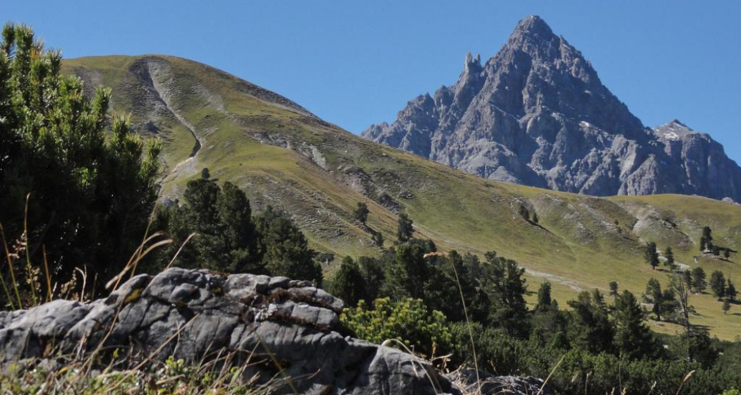
Nationalpark: Val Mingèr – Sur il Foss – Fuorcla Val dal Botsch – Ofenpassstrasse
Medium
13.3 km
6:15 h
1097 mhd
872 mhd


Show all 4 images

A classic pass hike that connects Val Mingèr with the Ofenpass region. The flora on the ascent is among the most beautiful in the entire Swiss National Park.
Best Season
Jan
Feb
Mär
Apr
Mai
Jun
Jul
Aug
Sep
Okt
Nov
Dez
Start
PostBus stop, Minger
Destination
PostBus stop Stabelchod (P8)
Coordinates
46.730648, 10.305566
Details
Description
A varied pass hike that links two regions of the Swiss National Park with different topographies. In addition to the species-rich mountain flora, the possibility of observing deer in the Val Mingèr, the witch's head, the alluvial fans in the rear Val Plavna and the magnificent view from the top of the pass on the Fuorcla Val dal Botsch, 2677 metres above sea level, await you. Note: Dogs are not allowed in the Swiss National Park, not even on a leash. Further information and all protection regulations can be found at www.nationalpark.ch/en/visit/hiking/protection-regulations/.
Geheimtipp
A visit to the Museum Schmelzra in S-charl, with its bear exhibition, is very rewarding. The experience-oriented exhibition gives an insight into the past, the way of life, the biology and the return of the brown bears. It is especially suited for children.
On the adjacent bear adventure trail, 9 interactive stations captivate young and old and provide practical tips on how to behave in a bear area.
Sicherheitshinweis
Mountain hike (white-red-white). Steep scree field on the descent from the Fuorcla towards Val Plavna. Snow can be expected here in spring and autumn. Surefootedness required. This hike requires elementary alpine experience, orientation skills, hiking boots are recommended.
Emergency call:
144 Emergency call, first aid
1414 Mountain rescue REGA
112 International emergency call
Ausrüstung
Hiking shoes, warm clothing, sun and rain protection, walking sticks if needed, binoculars recommended.
Directions
From the Mingèr post bus stop, the path leads over the dam wall directly into the National Park. On the left, caves appear as if carved in stone, and the head of a witch can be seen. The path leads idyllically uphill along the stream to the Mingèr rest area. The meadow at this resting place is home to many marmots, while many deer often graze on the opposite slope. The trail leads west to the Sur il Foss crossing (2317 m a.s.l.). The route now leaves the National Park and leads through huge scree fields first downhill and then slightly uphill again to the Fuorcla Val dal Botsch pass (2677 m a.s.l.). Here the view opens up to the north, to the Pisoc chain, the striking peak of Piz Plavna Dadaint and the valley floor of Val Plavna. From here the route zigzags over 400 metres of altitude across flower-filled pastures back into the National Park. Along the rushing Ova da Val dal Botsch, the trail winds past the Val dal Botsch rest area to the Stabelchod post bus stop (P8).
Directions
Public Transport
- With the Rhaetian Railway (from Chur, Landquart/Prättigau or from the Upper Engadine) hourly to Scuol-Tarasp station.
- Continue by PostBus to the PostBus stop Mingèr
Arrival information
- From the north: via Landquart - Klosters by car transport through the Vereina Tunnel (Selfranga - Sagliains) or via the Flüela Pass into the Lower Engadine on the H27, as far as Scuol and then towards S-charl.
- From the east: via Landeck / Austria in the direction of Reschenpass, after Martina on the H27 to Crusch, as far as Scuol and then in the direction of S-charl.
- From the south: via Reschenpass to Martina, then towards St. Moritz on the H27 to Scuol and then towards S-charl.
Parken
Mingèr
Responsible for this content Tourism Engadin Scuol Samnaun Val Müstair AG.
This content has been translated automatically.

This website uses technology and content from the Outdooractive platform.