Silvretta Historica – Sennentour


Show all 5 images

Details
Description
From the mountain station of the chairlift, the path leads westwards below the Prui mountain restaurant. Through a sparse forest, the first 150 meters of altitude are mastered.
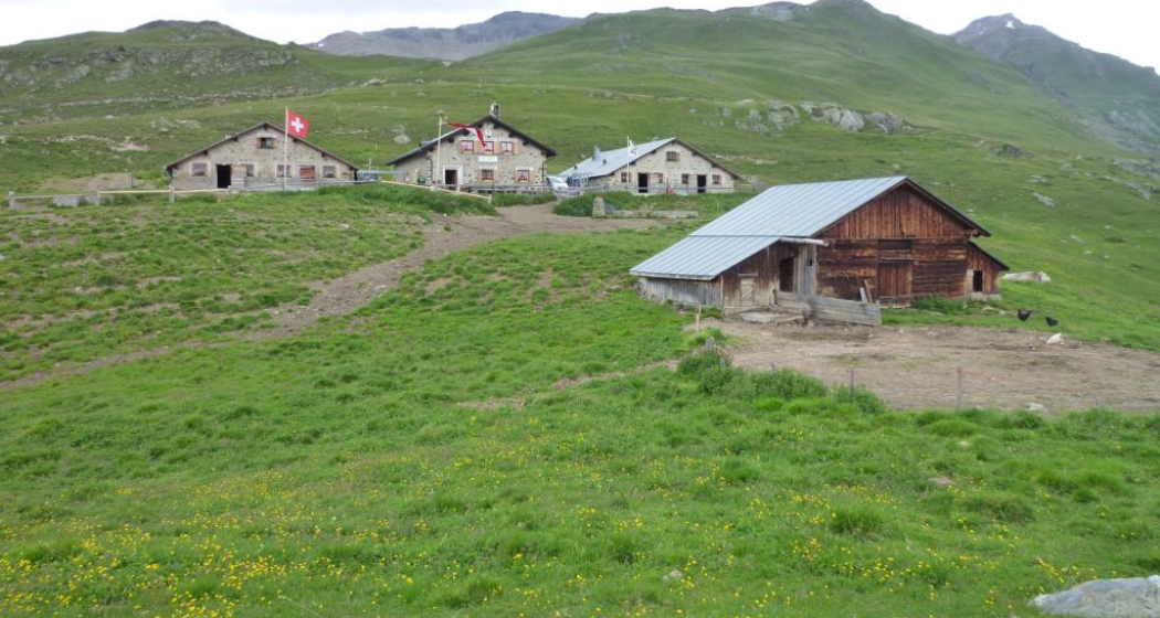
Leisurely uphill it then goes promising, with the mighty Lower Engadine Dolomites in view to Alp Laret. The Alp Laret, which is located in a panoramic position, is only managed during the summer seasons. Just behind Alp Laret, the descent into Val Tasna begins. Soon you can see the roofs of Alp Valmala on the other side of the valley.
Before crossing the Tasnan, it is advisable to make a detour to Alp Urezzas, especially for those interested in history. At Plan d'Agl you finally cross the Tasnan, from now on you are on Ardezer Boden. In a north-west direction, the Val d'Urschai leads to the Futschölpass, the border crossing into the neighbouring Montafon.
At the entrance of this valley, where the large boulders can be seen, there are sites that prove that this crossing was already used by hunters over 10,000 years ago. Continuing in the direction of Alp Urezzas at Plan d'Agl, a closer look reveals the outlines of an old cattle pen that stood there over 2,500 years ago. The Urezzas alpine hut is a bit more recent, it was built in 1832 and steadily expanded in the last century. The path leads steadily down the valley past Alp Valmala. In the summer months you can buy goat cheese or a small refreshment here.
The further path leads along the Tasnan, whose water is now also used for electricity production, comfortably down to Ardez.
Sicherheitshinweis
The tour was evaluated in favorable weather conditions, the current weather conditions and weather forecasts must be observed before the start of the tour. This hike requires an elementary alpine experience, orientation skills. Trekking shoes are recommended.
Emergency call:
144 Emergency call, first aid
1414 Mountain rescue REGA
112 International emergency call
Ausrüstung
Directions
From the mountain station of the Ftan-Prui chairlift below the mountain restaurant westwards
Continue slightly uphill to Alp Laret
Behind Alp Laret into Val Tasna to Alp Valmala
Cross the Tasnan
at Plan d'Agl In a northwesterly direction, the Val d'Urschai leads to the Futschölpass
Continue towards Alp Urezzas
From the Urezzas alpine hut down the valley to Alp Valmala
Along the Tasnan down to Ardez
Directions
Public Transport
By Rhaetian Railway (from Chur, Prättigau or Upper Engadine) or by PostBus (from Martina, Sent or Tarasp) every hour to Scuol-Tarasp station.
Direct hourly PostBus connection from Scuol-Tarasp to the PostBus stop Ftan, cumün
Arrival information
- From the north: via Landquart – Klosters by car transport through the Vereina tunnel (Selfranga - Sagliains) or over the Flüela Pass into the Lower Engadine on H27
- From the east: via Landeck / Austria in the direction of St. Moritz on H27
- From the south: via Reschenpass (Nauders-Martina) or Ofenpass (Val Müstair-Zernez) on H27
Ftan can be reached from the Engadine road H27 from Ardez or from the western end of the village of Scuol in 10 minutes by car (25 minutes drive from Veraina south portal)
Parken
- Parking at the Ftan chairlift valley station
Responsible for this content Tourism Engadin Scuol Samnaun Val Müstair AG.
This content has been translated automatically.

This website uses technology and content from the Outdooractive platform.